Volcanoes, Lake Basins, and Coral Rag: The Geology Behind Tanzania’s Commodity Map
Published 28 September 2026 · Commodities.tz Editorial
The pattern isn’t arbitrary
Look at a map of Tanzanian cash crops and a clear pattern jumps out: Arabica coffee clusters on two separate highland systems a thousand kilometers apart, Robusta belongs almost exclusively to one lake-shore corner, cashew occupies a single stretch of sandy southeastern coast, and cloves are all but confined to two small islands. This isn’t a marketing artifact or a colonial accident dressed up as agronomy. Each crop has genuine, documented physical requirements — altitude, temperature, rainfall pattern, soil chemistry — and Tanzania’s regions differ from each other on exactly those variables, because the country’s geology itself is not one thing. Young, still-active volcanoes; ancient, worn-down crystalline mountains; a lowland lake basin; a coral-built island archipelago; a sandy coastal plain — these are physically different kinds of ground, and they grow physically different crops. Colonial administrations then took those existing constraints and hardened them into institutions — cooperative unions, state marketing monopolies, forced-planting decrees — that are still the shape of the trade today.
Young volcanoes make Arabica country
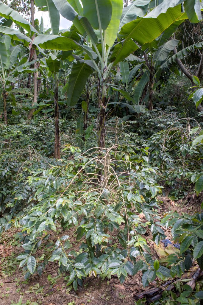
Kilimanjaro and Mount Meru (the massif behind Arusha) are geologically young stratovolcanoes — Kilimanjaro’s Kibo cone last erupted an estimated 150,000–200,000 years ago and still vents gas from its crater. Volcanic soils of this kind — Andosols, in soil-science terms — are unusually fertile: well-drained, mineral-rich in potassium, magnesium, calcium and phosphorus, and resistant to waterlogging because of the slope and porous ash-derived structure. On Kilimanjaro’s mid-elevation southern and eastern slopes this soil sits inside the altitude band Arabica actually needs. Arabica evolved in cool highland conditions and performs best in roughly the 18–23°C range; commercial agronomy generally places its productive zone between about 1,300 and 1,800 meters, with Robusta confined to lower, hotter ground below roughly 800–1,000 meters. Kilimanjaro and Meru’s cultivated belt — the Chagga and Meru “home garden” zone, coffee interplanted with banana, beans and other food crops under a light tree canopy — sits at almost exactly this elevation. This is not a coincidence of Chagga agricultural preference; it’s the volcano’s altitude gradient meeting the plant’s physiological limits.
The same volcanic logic, independently confirmed, applies to the Southern Highlands. Mbeya and Songwe sit at the Rungwe Volcanic Province, a genuinely active volcanic field — Mount Rungwe, Ngozi and Kyejo — with pyroclastic ash cover and the last major eruptions dated to the medieval period. The Nyakyusa people’s banana-and-coffee cultivation on Rungwe’s lower slopes runs on the same kind of young, mineral-rich volcanic soil as Kilimanjaro’s, at a comparable highland elevation. Tanzania Coffee Board’s grouping of Kilimanjaro, Arusha, Mbeya and Songwe as its leading Arabica zones lines up with two separate, geologically unrelated volcanic systems that happen to produce the same soil-and-altitude combination.
History then locked this in institutionally, not just agronomically. German colonial administrators, having taken Kilimanjaro under the 1885–86 partition of East Africa, pushed European-run coffee estates from the 1890s and built the Tanga–Moshi railway (completed 1911) specifically to move the crop. The Kilimanjaro Native Co-operative Union, founded in 1933, still markets tens of thousands of members’ coffee today, and Moshi remains the site of the national coffee auction — a direct institutional legacy of where the Germans decided to put their agricultural infrastructure a century earlier, on ground the geology had already made suitable.
Ancient mountains, poorer soils — Tanzania’s spice belt is a different kind of highland
Not every highland district in Tanzania is volcanic, and the distinction matters. The Eastern Arc Mountains — the chain running from the Taita Hills in Kenya through the Usambaras (Tanga’s Lushoto/Muheza/Mkinga districts), the Ulugurus (Morogoro), and on toward the Southern Highlands — are ancient crystalline Precambrian basement rock, uplifted by block-faulting starting roughly 30 million years ago. This is geologically the opposite of Kilimanjaro’s young ash cones: soils weathered off this old granitic and gneissic bedrock are generally less fertile than fresh volcanic soil. That difference plausibly explains why these particular districts became Tanzania’s cardamom, cinnamon, black pepper and clove-adjacent spice belt rather than intensive coffee country: spices are comparatively tolerant of altitude-driven cool microclimates without needing the same soil richness coffee rewards. This causal link — poorer basement soils steering these districts toward spices rather than coffee — is a reasonable interpretation of the geological contrast, not a claim any single source states outright, and should be read as informed inference rather than settled fact. What is independently documented is that Tanga, Morogoro and Mbeya are grouped together as Tanzania’s three main cardamom/pepper-producing regions, and that all three straddle Eastern Arc districts.
A lake basin makes Robusta country
Kagera sits low against the western shore of Lake Victoria, and this is where the country’s Robusta production is concentrated, mainly in Kyerwa and Karagwe districts, grown under banana-tree shade. Robusta is agronomically the opposite of Arabica in almost every respect that matters here: it tolerates — even prefers — lower elevation and higher heat, with productive lowland zones commonly cited around 800–1,500 meters and mean temperatures in the low-to-high 20s°C, well below Arabica’s cooler highland optimum. Kagera’s Lake Victoria basin position gives it exactly that lower, warmer profile relative to Kilimanjaro or Rungwe. Banana-coffee intercropping is a documented, studied practice on the Ugandan side of the same Lake Victoria basin, sharing Kagera’s climate and geology; it is reasonable to treat this as the same regional farming system rather than a Kagera-specific innovation, but the agronomic literature verified here comes from the Ugandan side of the basin, not Kagera-specific field studies — the fit should be read as a strong regional analogy, not site-specific proof. Interestingly, German colonial administrators initially mandated Arabica planting around Bukoba in 1911; Robusta’s dominance in Kagera today reflects the crop that actually suited the basin’s lower, warmer conditions winning out over the colonial administration’s original preference.
Sandy, low-fertility soils make cashew country
Mtwara and Lindi, together producing the clear majority of Tanzania’s marketed cashew crop, sit on genuinely different ground from any of the coffee zones: low-altitude (generally under 800 meters), warm, semi-arid coastal plain. Academic soil work from the Naliendele Agricultural Research Institute in Mtwara — conducted with Belgian soil scientists and published through the Soil Science Society of East Africa — found that cashew performs best precisely where the soil is poorest in conventional terms: deep, loose, well-drained, highly-weathered sandy Ferralsols, especially on the Makonde plateau. The researchers describe cashew as effectively a “sand-loving plant” that tolerates low chemical fertility and is actively harmed by heavy, compact clay soils. Climatically it needs 800–1,600mm of annual rainfall concentrated in 5–7 months with a pronounced dry season, and a mean temperature of 24–28°C — a match for the coastal southeast’s climate. This same coastal belt sits within the Eastern miombo woodlands ecoregion (Brachystegia/Julbernardia-dominated), a vegetation type that itself favors well-drained, moderately infertile soils — the same soil chemistry cashew thrives on. That correlation between the crop and the surrounding natural vegetation is a genuine ecological fit, not a coincidence of colonial crop policy.
Coral islands, not volcanic ones — correcting a common assumption
It’s tempting to assume Zanzibar and Pemba’s clove monoculture rests on volcanic soil, the way Kilimanjaro’s coffee does. That assumption doesn’t survive a check of the geology. Unguja and Pemba are part of a coastal sedimentary province built from coral-reef limestone and associated carbonate deposits, formed through Quaternary sea-level cycles — there is no volcanic activity in their geological history at all. What does vary across the islands is soil depth and origin: on Unguja’s western and central side, deeper, more fertile “kichanga” soils (formed over older sedimentary rock) support farming, while the eastern side sits on thin, poor “kinongo” soils directly over exposed coral rag. Pemba’s soils are generally deeper and its rainfall higher than Unguja’s flatter terrain — which is the actual, geology-grounded reason multiple sources give for Pemba out-producing Unguja in cloves, not volcanic fertility.
The real driver of the clove economy is historical, not geological. Clove trees were brought to Zanzibar around 1812; the decisive turn came after Said bin Sultan of Oman moved his capital to Zanzibar in the 1830s and used enslaved plantation labor to force clove cultivation at scale, reportedly decreeing that three clove trees be planted for every coconut palm on Zanzibar and Pemba. That policy, not a soil type, is what made Zanzibar control an estimated 90% of the world clove market into the 1940s — a dominance built on forced labor and state mandate more than on any natural advantage the islands’ coral-derived soils gave them over other tropical clove-growing regions.
Colonial administrations turned physical constraints into fixed institutions
A consistent thread across every region above is that colonial-era decisions, made within the physical limits geology had already set, are still the shape of the trade. Germany built railways and estate agriculture toward Kilimanjaro and Tanga from the 1890s; Oman’s Sultanate imposed the clove economy on Zanzibar and Pemba in the 1830s through forced labor. Tanzania’s southern coffee frontier tells a genuinely later story: an archival history of Mbinga District (Matengo Highlands, Ruvuma) documents that throughout the entire German colonial period there was no dominant cash crop in the area at all — coffee was only introduced as a commercial crop after the British took over the territory in 1919, developing through the 1920s. That’s two to three decades after German-era coffee was already established around Kilimanjaro and Bukoba. Ruvuma’s coffee industry being comparatively new is a documented historical fact; whether the underlying land itself is agronomically more “marginal” than the northern zones is a separate claim this research did not independently verify, and is not asserted here as fact.
Reading the network’s regions through this lens
None of this replaces what the site’s individual region pages already document about who grows what, through which board, at what volume — that ground-level detail stays there. What the geology and history add is the why underneath twelve separate regional stories: two unrelated volcanic systems produce two Arabica belts a thousand kilometers apart; one lake basin’s lower, warmer climate produces the country’s Robusta; one ancient, non-volcanic mountain chain produces a spice belt instead of a coffee belt; one sandy, low-fertility coastal plain produces the cashew economy; and one coral-built archipelago’s colonial-era forced-labor economy — not its rock — built the clove trade. Crop choice, in other words, mostly follows the ground. The trading system that formalized it followed the colonial administrators who arrived after the ground had already decided.
- Naliendele Agricultural Research Institute / KU Leuven — Dondeyne et al., "Landscapes and soils of South Eastern Tanzania: their suitability for cashew" (Soil Science Society of East Africa, 2001/2003) — https://lirias.kuleuven.be/server/api/core/bitstreams/8620aa5a-cab2-4399-9b14-b9553dbbb07c/content — accessed 2026-09-27
- Stellenbosch University — Yustina Samwel Komba, "A Socio-economic History of Coffee Production in Mbinga District, Tanzania, c.1920-2015" (PhD dissertation, 2021) — https://scholar.sun.ac.za/server/api/core/bitstreams/be4b0658-1aa6-47fb-b819-90488cee087a/content — accessed 2026-09-27
- PLOS ONE — "Continental Island Formation and the Archaeology of Defaunation on Zanzibar, Eastern Africa" — https://journals.plos.org/plosone/article?id=10.1371%2Fjournal.pone.0149565 — accessed 2026-09-27
- AramcoWorld — "Spice Migrations: Cloves" — https://www.aramcoworld.com/articles/2021/spice-migrations-cloves — accessed 2026-09-27